Mapping sand area expansion using long-term Landsat time series
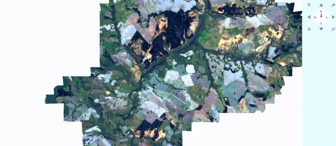
Today my student Dieison Morozoli da Silva defended his BSc thesis. Using long-term Landsat time series he found that sand areas in the Puitã river watershed, Southern Brazil, have increased by 17 km² since 2000. Here is a 3D view of the study area:
Estimated sand area in Puitã river watershed over time:
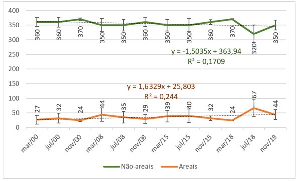
Animation and figure by Dieison Morozoli da Silva. License CC BY-SA 4.0.